Queensland

300 Projects in Queensland showing 241-260

Filter projects

Filters

Status
Status
Programs
Programs
Type
Type
Reset
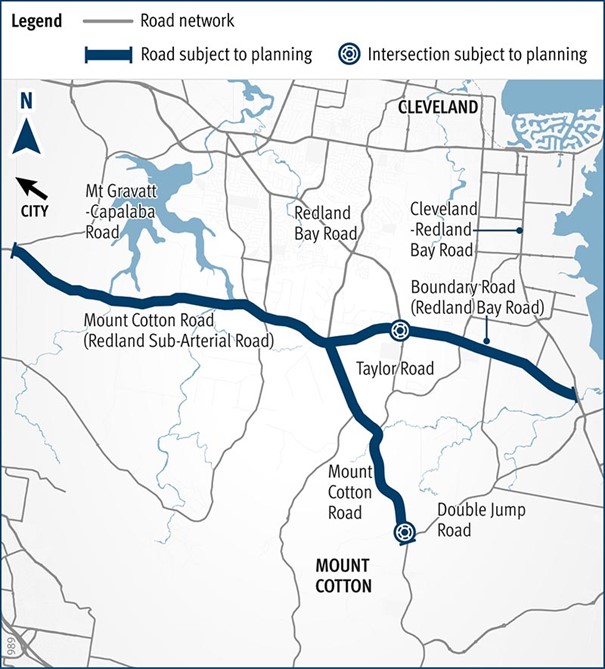
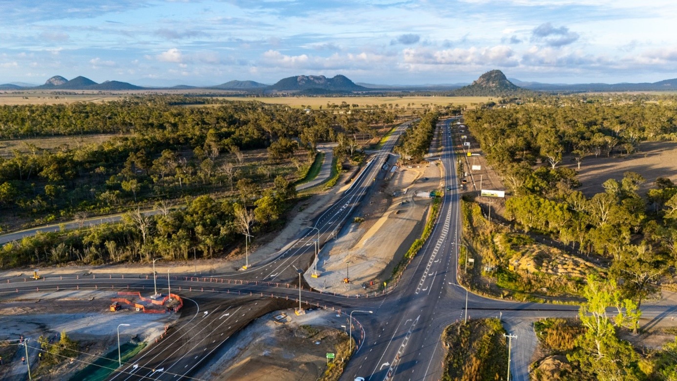
  1. Redland Sub-Arterial Road, Mount Gravatt Capalaba Road to Tingalpa Creek, widening, business case (planning)

    We are undertaking planning for Mount Cotton Road, Redland Bay Road and the Redland Sub-Arterial Road, including the Double Jump Road, Ney Road and Taylor Road intersections...

    • Metropolitan Region
    Mount Cotton Road-Redland Bay Road location map
  2. Richmond - Winton Road, strengthen and widen pavement

    The department will improve all weather access, travel reliability and safety along the Richmond – Winton Road by widening and strengthening this section of the road...

    • North Queensland Region
    No image supplied
  3. Road Asset Management Contract and Responsive Maintenance Contract—Metropolitan

    Maintenance services for the Metropolitan Region are currently carried out by both Fulton Hogan and RoadTek under a new Road Asset Management Contract (RAMC) and Responsive Maintenance Contract (RMC...

    • Metropolitan Region
    No image supplied
  4. Road Asset Management Contract and Responsive Maintenance Contract—South Coast

    The generation 2 RAMC contract includes routine and programmed maintenance and rehabilitation activities in addition to stewardship and asset management services for much of the TMR network in South...

    • South Coast Region
    No image supplied
  5. Road Asset Management Contracts—North Coast

    Maintenance services for the North Coast Region are carried out by TMR Contractors, RoadTek under a Responsive Maintenance Contract (RMC) and Downer under a Road Asset Management Contract (RAMC)...

    • North Coast Region
    No image supplied
  6. Rockhampton Railyards Rejuvenation, Heritage Precinct

    This precinct features the full-circle Roundhouse and surrounding heritage buildings. We are creating a Master Plan to transform the precinct for community and light commercial use. This plan will...

    • Central Queensland Region
    Close-up view of the historic, disused roundhouse at the Rockhampton Railyards Heritage site, featuring a circular structure with a stationary turntable in the center
  7. Rockhampton Railyards Rejuvenation, Industrial Precinct

    We are undertaking significant remediation work to rejuvenate the old railyards and restore this precinct. The precinct features more than 20 different warehouses and storage sheds, some of which have...

    • Central Queensland Region
    Aerial view of the Rockhampton Railyards industrial precinct, showcasing rail tracks, various structures, and the historic circular roundhouse
  8. Rockhampton Ring Road

    The Rockhampton Ring Road is a major infrastructure project within the Central Queensland region...

    • Bruce Highway Upgrade Program
    • Central Queensland Region
  9. Rockhampton–Yeppoon Road, Yeppoon Road Upgrade

    We are committed to delivering targeted upgrades between the connection with the Bruce Highway in Parkhurst and the Tanby Road roundabout in Yeppoon...

    • Central Queensland Region
    Yeppoon Road Upgrade project construction underway, showing new alignment
  10. Ross River Road, Mabin Street to Rolfe Street, improve safety

    The department is undertaking safety improvement works at various locations across Ross River Road from the Mabin Street intersection to the Rolfe Street intersection...

    • North Queensland Region
    • High Risk Roads Targeted Road Safety Program
    No image supplied
  11. Salisbury to Beaudesert Passenger Rail

    The Australian and Queensland Governments are investigating future rail requirements between Salisbury and Beaudesert...

    • South Coast Region
    • Metropolitan Region
    No image supplied
  12. Samford Road safety improvements

    Improving safety along Samford Road, between Lomandra Access Road picnic area and Camp Mountain Road, and at Camp Mountain Road intersection...

    • North Coast Region
    • Targeted Road Safety Program
    No image supplied
  13. Samford Sub-Arterial Road (Samford Road) and Glen Holm Street, upgrade intersection and Samford Sub-Arterial Road (Samford Road) and Osborne Road intersection planning (known as the Samford Road intersection improvements)

    We are currently undertaking community consultation on proposed safety and traffic improvement works at key intersections along Samford Road, at Pickering Street, Glen Holm Street and Osborne Road...

    • Metropolitan Region
    Map of Samford Road interection improvements
  14. Scarborough State Boat Harbour Master Plan

    Scarborough Boat Harbour is vibrant part of the Redcliffe Peninsula community...

    • North Coast Region
    Aerial view of Scarborough Harbour
  15. Smith Street Connection Road, Olsen Avenue to Kumbari Avenue, construct cycleway

    Future bicycle connections and infrastructure to enable bicycle riders in the community to use the road safely...

    • South Coast Region
    The map shows the locality of the proposed Smith Street Connection Road, Olsen Avenue to Kumbari Avenue, construct cycleway works. Kumbari Avenue is located to the north of the project location in Southport. A solid dark blue line indicates the project extent, which encompasses Smith Street Connection Road west of the intersection and Kumbari Avenue, which is located north and south of the intersection. Village Boulevard is also highlighted on the map, west of the project location.
  16. South Brisbane Transport and Mobility Study

    We are conducting a multi-modal study of the ongoing and increasing transport pressures relating to road, active transport and public transport modes in Brisbane’s inner south...

    • Metropolitan Region
    No image supplied
  17. Southern Freight Rail Corridor Study

    The Southern Freight Rail Corridor has been identified as a future route connecting the Western Rail line near Rosewood to the interstate railway north of Beaudesert...

    No image supplied
  18. Southern Queensland 2022 flood reconstruction works completed

    Repairs are underway across South East Queensland after extensive and severe flooding was caused by sustained heavy rainfall in late February 2022...

    • Metropolitan Region
    • North Coast Region
    • South Coast Region
    • Southern Queensland Region
    • Natural Disaster Program
    Landslip on Gold Coast - Springbrook Road
  19. Southern Sunshine Coast Roads Improvement Study

    The Southern Sunshine Coast Roads Improvement Study aims to improve road network safety and increase capacity on roads within the southern Sunshine Coast area to cater for the growing population...

    • North Coast Region
    No image supplied
  20. Stafford Road and South Pine Road intersection (Everton Park), upgrade

    We have finalised a preferred concept plan for the intersection of Stafford Road and South Pine Road, Everton Park...

    • Metropolitan Region
    No image supplied

Last updated: 19 July 2024